

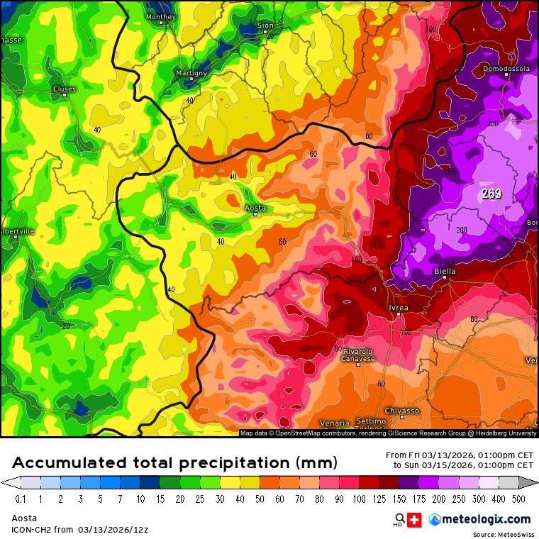
A major late-season winter storm is expected to bring significant snowfall across Italy’s Aosta Valley this weekend, with forecasts indicating up to 80–100 cm of new snow in the eastern valleys, including areas around Cervinia and Monterosa Ski.
After nearly two weeks of mild conditions across the Alps, the return of winter weather could bring rapidly changing mountain conditions and elevated avalanche risk across parts of the region.
Meteorologists expect precipitation to begin early Saturday morning, first affecting the Cervino (Matterhorn) and Monte Rosa valleys before spreading across the rest of the region during the day.
These intense snowfall events are increasingly linked to extreme weather in the Alps, where rapid shifts between storms and warming phases are becoming more common.
Comparable instability has also led to fatal incidents elsewhere, including multiple avalanche deaths in northern British Columbia following recent snowfall cycles.
Update – 15 March 2026
First reports from the eastern parts of the Aosta Valley suggest the storm has delivered significant snowfall across the Monte Rosa side of the region, with some valleys approaching one metre of fresh snow at altitude.
Local weather observers report approximately:
60–90 cm in Val d’Ayas (Champoluc area)
up to 80–100 cm in the Gressoney / Valle del Lys sector
around 80–100 cm in the Champorcher valley at higher elevations
The eastern valleys of the region typically receive the highest totals during southerly storm flows affecting the western Alps. During this event, precipitation intensified overnight as the snow line dropped to around 700–900 m, producing winter conditions across much of the region.
These accumulations broadly confirm earlier forecasts suggesting up to one metre of snow in parts of eastern Valle d’Aosta, particularly near the Monte Rosa massif.
UPDATE – Avalanche Alert Raised in Eastern Aosta Valley (14 March 2026)
Authorities in Aosta Valley have issued an orange avalanche alert for the eastern valleys of Gressoney, Ayas and Champorcher, as heavy snowfall continues across the western Alps and avalanche risk rises in parts of the Monte Rosa area.
Avalanche risk during major snowstorms is reported using the European Avalanche Danger Scale.
According to regional authorities, snowfall accumulations could reach 60 to 100 cm above 1,000 metres in these areas by the end of the storm. Elsewhere in the region, totals are expected to remain lower, generally 20 to 40 cm.
Officials warn that medium to large avalanches may occur, particularly in the Monte Rosa valleys, and in some cases could affect areas close to roads or inhabited zones.
During major snowfall events in the Alps, avalanche danger often rises to Level 3 (Considerable) or higher on the European avalanche danger scale.
➜ What Avalanche Danger Level 3 Means
At lower elevations precipitation may fall as rain, raising the possibility of local flooding, minor landslides and rockfallduring the storm cycle.
Source:
Centro Funzionale Regione Valle d’Aosta avalanche and weather alerts via
AostaSera.
Snow Intensifying Saturday Afternoon
According to regional forecasts, snowfall will initially be moderate and scattered Saturday morning, but conditions could intensify later in the day.
The strongest snowfall is expected Saturday afternoon and evening, particularly in the eastern valleys of the Aosta Valley.
Snow is forecast to continue through Saturday night and into Sunday morning before gradually weakening.
Thunderstorms are also possible Saturday evening near areas bordering Piedmont, with the potential for lightning embedded within the storm system.
Snow Line Dropping Rapidly
One notable aspect of the storm is the rapidly falling snow line.
Forecast models suggest:
• 1500–1600 m Saturday morning
• 1000–1200 m by Saturday evening
• Possibly 500 m overnight into Sunday, meaning snow could briefly reach Aosta city
This drop could allow snow to accumulate well below typical late-season elevations.
Expected Snowfall Totals
Snowfall totals will vary depending on local conditions, but forecasts currently suggest:
Above 1600–1800 m
• 80–100 cm: Valle del Lys, Champorcher
• 50–70 cm: Val d’Ayas, Valtournenche, Val Clavalité
• 40–60 cm: Valpelline, St. Barthélemy, Cogne, Valsavarenche, Pila, Rhêmes Valley
• 20–40 cm: Valgrisenche, Mont Blanc valley
Around 1000 m
• 20–30 cm: Val d’Ayas and Valtournenche
• Up to 40–50 cm: Gressoney and Champorcher
Avalanche Risk Likely to Increase
Heavy snowfall combined with wind at high altitude could significantly increase avalanche danger across parts of the western Alps.
Strong southerly winds during the storm, followed by a shift to north-west winds on Sunday, may transport snow and form unstable slabs at higher elevations.
Backcountry travelers and skiers should closely monitor official avalanche bulletins over the coming days.
➡️ See also:
Understanding Avalanche Danger Level 3 (Considerable)
➡️ See also:
Understanding Avalanche Danger Level 4 (High)
A broader overview of recent instability across the region can be found in our report on the February 2026 Avalanche Cycle Across the Alps.
A Classic “Genoa Low” Alpine Snowstorm
Storm patterns like this are often linked to what meteorologists call a “Genoa Low” — a Mediterranean low-pressure system that forms near the Gulf of Genoa and pushes moist air north toward the Alps.
When this airflow collides with the Alpine barrier, it can produce very intense snowfall on the southern and eastern sides of the range, particularly in areas such as Monte Rosa, Gressoney, Champorcher and Val d’Ayas.
These systems are well known for producing large snowfall totals in a short period of time, especially in late winter and early spring.
A Classic Late-Season Alpine Storm
Large snowstorms in March are not unusual in the Alps. After mild periods, fresh snowfall combined with wind can quickly create complex snowpack conditions.
For skiers, the storm may bring excellent powder conditions once the weather clears — but patience and caution will be essential in the immediate aftermath of the storm.
Article updated: 14 March 2026 – avalanche alert information added for eastern Valle d’Aosta.
Sources
Aosta Valley Snow and Avalanche Bulletin
https://bollettinovalanghe.regione.vda.it/home-2
AINEVA – Italian Avalanche Information Network
https://aineva.it/en/avalanche-danger-bulletin/
Regional weather observers and forecasting networks in Aosta Valley.
 Planning your next trip to the Italian Alps?
 Planning your next trip to the Italian Alps?
If you’re heading to the Aosta Valley, take a look at Il Cuore della Valdigne, our family-owned apartment in Morgex, available for rent when we’re not using it ourselves.
It’s an ideal base to:
- Ski in Courmayeur, La Thuile and Pila
- Enjoy the mountains in summer (hiking, biking, nature)
- Explore the Mont Blanc valley in a quieter, more authentic setting.
 Ski in Courmayeur,
 Enjoy the mountains in summer (hiking, biking, nature)
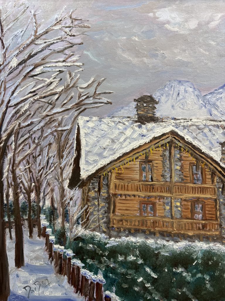
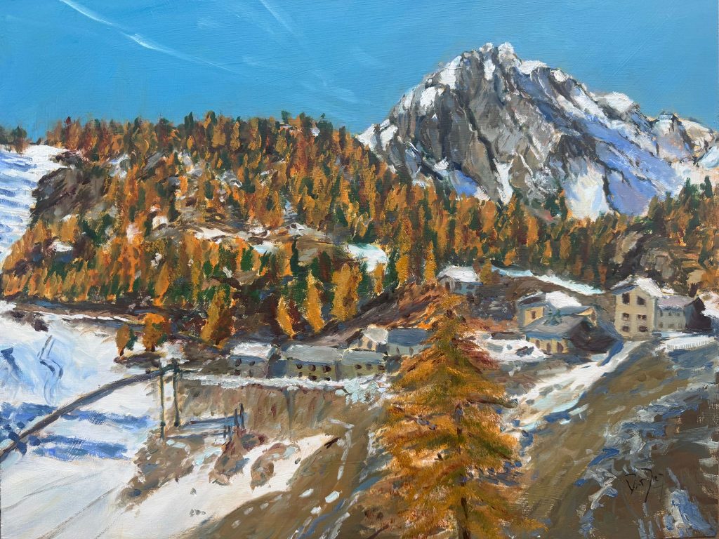
Check my Mountain Art on my Shop
You can go to my shop and see what have been inspiring me lately, lots mountain landscapes in soft pastels, and now in oils too. Go here to check my latest works!
Featured Image: Totally acumulated snow 13-15 April. Meteo Valle d’Aosta.


Discover more from The-Ski-Guru
Subscribe to get the latest posts sent to your email.
 Subscribe to The-Ski-Guru here.