Up to 1 Meter of Snow Forecast in Aosta Valley as Major March Storm Hits the Alps

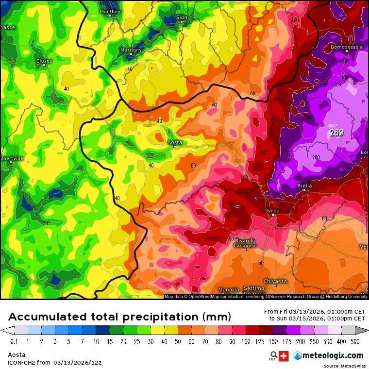
Totally acumulated snow 13-15 April. Meteo Valle d'Aosta.

A major late-season winter storm is expected to bring significant snowfall across Italy’s Aosta Valley this weekend, with forecasts indicating up to 80–100 cm of new snow in the eastern valleys, including areas around Cervinia and Monterosa Ski.

After nearly two weeks of mild conditions across the Alps, the return of winter weather could bring rapidly changing mountain conditions and elevated avalanche risk across parts of the region.

Meteorologists expect precipitation to begin early Saturday morning, first affecting the Cervino (Matterhorn) and Monte Rosa valleys before spreading across the rest of the region during the day.

These intense snowfall events are increasingly linked to extreme weather in the Alps, where rapid shifts between storms and warming phases are becoming more common.

Comparable instability has also led to fatal incidents elsewhere, including multiple avalanche deaths in northern British Columbia following recent snowfall cycles.

Continue reading “Up to 1 Meter of Snow Forecast in Aosta Valley as Major March Storm Hits the Alps”

Why Wet Avalanches Happen in Spring in the Alps

Wet snow avalanche on a sunlit alpine slope during spring thaw in the Alps

As winter transitions toward spring, avalanche conditions in the Alps often change in important ways. While mid-winter avalanches are frequently triggered by new snowfall and wind loading, late-season avalanches are more commonly linked to warming temperatures and melting snow.

These are known as wet avalanches, and they become increasingly common during late winter and spring across Alpine regions.

Understanding how and why wet avalanches form is essential for skiers, mountaineers and anyone travelling in the mountains during the warmer part of the season.


What Is a Wet Avalanche?

A wet avalanche occurs when liquid water weakens the bonds between snow grains, reducing the strength of the snowpack.

Unlike dry slab avalanches — which often break suddenly — wet avalanches typically occur when melting snow becomes heavy and unstable.

Continue reading “Why Wet Avalanches Happen in Spring in the Alps”

Saharan Dust Reaches the Alps as Freezing Levels Rise Above 3000 m

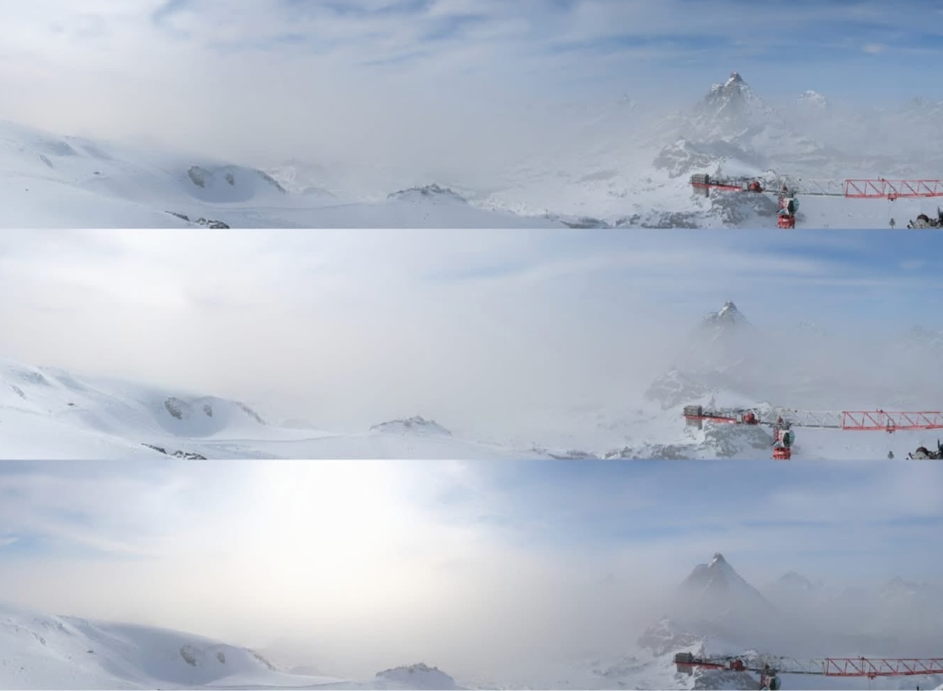
Saharan dust haze visible over the Alps at Piccolo Cervino above Cervinia

A hazy sky observed across parts of the Aosta Valley and the wider Alps in early March has an unusual origin: Saharan dust transported north across the Mediterranean.

Meteorological observations indicate that large quantities of fine sand particles from the Sahara Desert have been carried into Alpine air masses during a prolonged period of high pressure.

Similar Saharan dust events have been documented by atmospheric monitoring services across Europe, including observations from the Copernicus Atmosphere Monitoring Service, which regularly tracks large dust plumes transported from North Africa into the Mediterranean and Alpine regions. These atmospheric events can influence visibility, air quality and — when dust settles on snow surfaces — the evolution of the mountain snowpack.

The result has been a visible veil of haze in the atmosphere and dust deposition on snow surfaces at high altitude, something that can have important consequences for the evolution of the snowpack.

Webcam images from Piccolo Cervino (3883 m), above Breuil-Cervinia, show the progressive increase of dust suspended in the air during the day.

Meteorologists across the region also report exceptionally mild temperatures for the time of year, with freezing levels remaining unusually high for several consecutive days.

These episodes are part of a broader pattern of extreme weather in the Alps, affecting snow quality and melt rates.

Similar patterns are now visible beyond the Alps, where extreme heat has forced early resort closures in North America.

Continue reading “Saharan Dust Reaches the Alps as Freezing Levels Rise Above 3000 m”

Meteo Valle d’Aosta: Heavy Snowfall and Strong Winds Forecast Through Tuesday

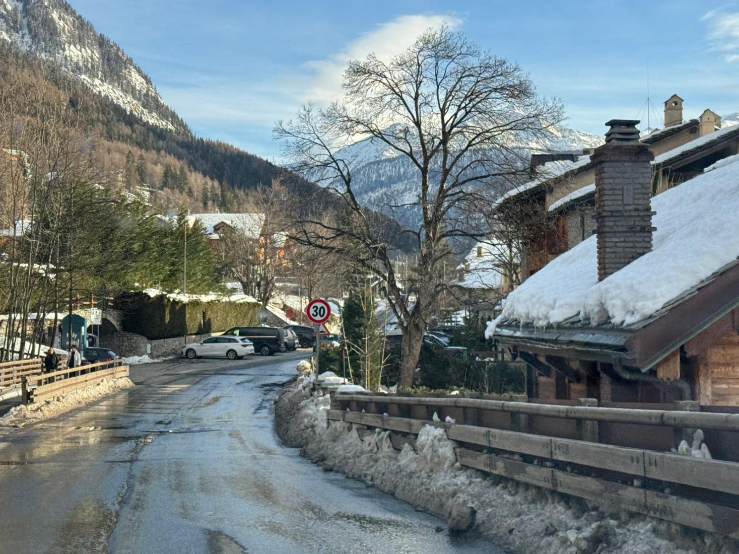
Courmayeur today in the afternoon, before the next snowstorm cycle. 15 Feb 26. Photo: The-Ski-Guru.

Snowfall intensifying across western sectors

The latest Valle d’Aosta snow forecast indicates heavy snowfall across the western sectors, with accumulations expected to continue through Tuesday morning.

According to Meteo Valle d’Aosta, abundant snowfall is expected along the Alpine border ridges, accompanied by strong north-westerly winds. The system is forecast to persist through the morning of Tuesday, February 17, with significant accumulations expected above 1500–1700 metres.

Continue reading “Meteo Valle d’Aosta: Heavy Snowfall and Strong Winds Forecast Through Tuesday”