


Introduction
A rockfall in the hamlet of Palleusieux, in Pré-Saint-Didier, has forced the evacuation of residential buildings and the closure of a section of road on the approach to Courmayeur, underlining ongoing slope instability on the Mont Blanc side of the Aosta Valley.
The incident occurred on 31 March 2026 and prompted immediate safety measures after rock debris reached areas close to inhabited properties. According to AostaSera, authorities assessed the slope as posing a serious risk to public safety, leading to precautionary evacuations and restrictions in the area.
Evacuations and Road Closure
Four apartment buildings in Palleusieux were evacuated as a precaution, while a section of the Route Mont Blanc was closed to traffic. This road represents a key access route between Pré-Saint-Didier and Courmayeur, although alternative access remains possible via the A5 motorway tunnel.
Initial assessments suggest that the instability is not limited to a single detached rockfall event. Regional reporting indicates that approximately 300 cubic metres of material detached from the slope, with further unstable blocks still present and under observation.
A Structural Instability, Not a One-Off Event
The response by authorities reflects the nature of the risk. Standard debris removal has been deemed too dangerous, and planned interventions instead focus on stabilisation and anchoring works. This approach suggests that the instability is embedded within the slope rather than being the result of an isolated collapse.
Further details reported by regional media indicate that a large unstable rock mass remains in place and that stabilisation works may take several weeks to complete, reinforcing the view that this is a persistent rather than temporary hazard.
A Known Risk Corridor on the Mont Blanc Side
The location of the event places it within a wider zone of known instability on the Mont Blanc massif. The nearby area of Planpincieux, above Val Ferret, has been closely monitored in recent years due to glacier movement and the risk of collapse.
Although the current rockfall is a separate event, both situations reflect the same broader context of steep terrain, complex geology, and exposure to environmental stress. The Mont Blanc corridor is one of the most closely observed areas in the Alps in terms of slope and glacier instability.
Seasonal Timing and Contributing Factors
The timing of the rockfall, at the transition from winter to spring, is consistent with periods of increased instability in mountain environments. Freeze–thaw cycles play a key role, as water infiltrates fractures in the rock, freezes, expands, and gradually weakens the structure.
Warmer periods accelerate this process, particularly when combined with snowmelt and water infiltration. These mechanisms are well documented, but their effects become more pronounced when temperature variations are sustained over time.
Part of a Wider Pattern in the Alps
This event fits into a broader pattern of mountain infrastructure exposure that has been observed across the Alps and beyond. Similar dynamics have affected transport corridors, ski areas, and valley settlements, where infrastructure is often located directly below steep and potentially unstable slopes.
👉 You can read more in: Mountain Infrastructure Risk in the Alps & Pyrenees
The interaction between natural processes and built environments is becoming an increasingly important aspect of Alpine risk management.
What Happens Next
At the time of writing, no further official updates have been reported beyond the initial emergency measures and planned stabilisation works. Monitoring of the slope continues, and future actions will depend on how conditions evolve in the coming weeks.
The evacuation of buildings and the decision to avoid immediate clearing operations suggest a precautionary approach, prioritising safety over rapid reopening.
Conclusion
The rockfall at Palleusieux is not simply a localised incident. It highlights the ongoing exposure of Alpine infrastructure and settlements to slope instability, particularly in high-relief environments such as the Mont Blanc massif.
As seasonal transitions become more dynamic and temperature variations more pronounced, these types of events may become more frequent or more complex to manage. The challenge lies not only in responding to individual incidents, but in understanding the broader patterns shaping mountain risk.
Sources
- AostaSera – Frana a Palleusieux, 4 April 2026
- Gazzetta Matin – Pré-Saint-Didier rockfall report, April 2026
- ANSA – frana a Pré-Saint-Didier, sgombero condomini

 Planning your next trip to the Italian Alps?
 Planning your next trip to the Italian Alps?
If you’re heading to the Aosta Valley, take a look at Il Cuore della Valdigne, our family-owned apartment in Morgex, available for rent when we’re not using it ourselves.
It’s an ideal base to:
 Ski in Courmayeur,
 Enjoy the mountains in summer (hiking, biking, nature)
Check my Mountain Art on my Shop
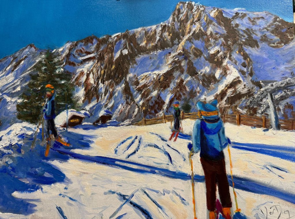
You can go to my shop and see what have been inspiring me lately, lots mountain landscapes in soft pastels, and now in oils too. Go here to check my latest works!

Skiing from Zerotta. Oils on panel. 18″x15″. In my shop.
Featured Image: Palleusieux- Google Maps.


Discover more from The-Ski-Guru
Subscribe to get the latest posts sent to your email.
 Subscribe to The-Ski-Guru here.