

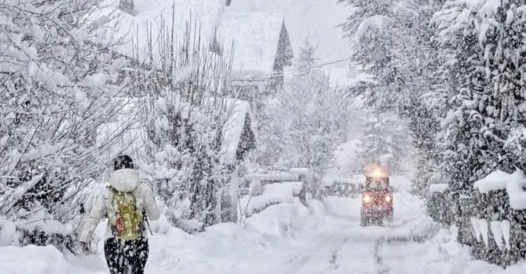
Aosta Valley avalanche danger is rising rapidly as fresh snowfall, strong winds and weak layers combine to create a phase of marked instability across the region, according to official monitoring services.
Current avalanche situation
According to Fondazione Montagna Sicura and AINEVA, the snowpack in the Aosta Valley is entering a critical phase, with avalanche danger expected to increase further over the coming days.
Snowfall has been ongoing since Tuesday, with peak accumulations expected by Thursday. In the north-western sectors of the region, fresh snow totals may exceed 1 metre above 1,600 m.
### Local civil protection alert (Aosta Valley): According to local authorities cited by Aosta Sera, an **official weather and avalanche alert** is in place across parts of the Aosta Valley as snowfall and strong winds intensify. An initial **yellow alert (ordinary criticality)** is expected to escalate to an **orange alert (moderate criticality)** by Wednesday, with affected areas including Valdigne, Gran Paradiso, Gran San Bernardo and Valtournenche. Forecasts indicate up to **35–40 cm of new snow around 1,500 m**, with wind transport further increasing avalanche risk.
Main instability factors
- Unfavourable snow layering: initial cold, light snow is being overlain by heavier and wetter snow as temperatures rise, creating weak bonding between layers.
- Balling snow (graupel / pellets) is present, further increasing instability.
- Fresh snow avalanches, potentially large, are expected on steep slopes.
Wind slabs and snow transport
From Wednesday, strong W–NW winds are forecast to form widespread and cohesive wind slabs, significantly increasing the load on the snowpack and the likelihood of slab avalanches, even at lower elevations.
Old snow and deep instabilities
Persistent basal weak layers are present across much of the territory. The additional load from new snow may reactivate deep instabilities, with the potential for large full-depth avalanches.
Small initial releases may rapidly evolve into much larger events.
South-facing slopes are particularly sensitive due to the presence of crusts and melt-freeze layers, which further worsen bonding between old and new snow.
Official recommendation
❗ Extreme caution is strongly advised.
Backcountry travel currently requires:
- conservative terrain choices
- careful evaluation of slope exposure
- continuous monitoring of weather and avalanche bulletins
Mountain users are urged to follow the evolution closely through official forecasts and avalanche reports.
Source: AINEVA / Fondazione Montagna Sicura
https://bollettini.aineva.it/
🔲 Avalanche Safety – Read Before Skiing Off-Piste
Recommended internal links:
- Avalanche Awareness: What Every Skier Needs to Know
- Avalanche Danger Levels Explained: What “Level 3 – Considerable” Really Means
- Wind as an Avalanche Trigger
- Why Skiing Alone Is Dangerous in the Mountains
 Planning your next trip to the Italian Alps?
 Planning your next trip to the Italian Alps?
If you’re heading to the Aosta Valley, take a look at Il Cuore della Valdigne, our family-owned apartment in Morgex, available for rent when we’re not using it ourselves.
It’s an ideal base to:
- Ski in Courmayeur, La Thuile and Pila
- Enjoy the mountains in summer (hiking, biking, nature)
- Explore the Mont Blanc valley in a quieter, more authentic setting
 Ski in Courmayeur,
 Enjoy the mountains in summer (hiking, biking, nature)
Check my Mountain Art on my Shop
You can go to my shop and see what have been inspiring me lately, lots mountain landscapes in soft pastels, and now in oils too. Go here to check my latest works!
Featured Image: Photo: Meteo Valle d’Aosta. 🏔️ Avalanche Alert – Aosta Valley: Rapidly Rising Instability (10 Feb 2026)


Discover more from The-Ski-Guru
Subscribe to get the latest posts sent to your email.
 Subscribe to The-Ski-Guru here.
You must be logged in to post a comment.